


Route type: Two-way
Difficulty: 2/5 (Moderate)
Duration: 4h 45min
Length: 12,4km
Equivalent length: 12,4 km
Ascent: 356m
Descent: 861m
Maximum altitude: 1412m
Minimum altitude: 781m
Drinking water: Yes
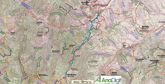
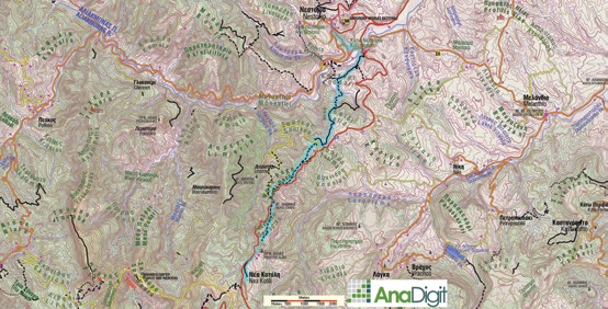
The mule track between Nea Kotyli and Nestorio (which of course started from Palia Kotyli) followed a course parallel to today’s asphalt road as far as Soutko, and then dropped into the valley between Skafidi and Kontari, to reach the banks above the Aliakmonas and end at the Kotyli bridge. This route, 2 km shorter than the asphalt, has undergone various interventions, but remains passable and distinct.
Starting from the square of Nea Kotyli, we pass the hill of Profitis Ilias and continue on the right side of a conspicuous ridge, which bears a large number of ruined defensive structures from the Civil War. We arrive at the chapel of Agios Ioannis Prodromos (watering trough with good water).
Opposite, we enter an old lane, which passes south of peak 1295 and fades out at the Soutkos meadow. We cross through clusters of oaks and end up at the forest road serving the chapel of Agios Nikitas. After 350 m we meet and follow the axis of an old aqueduct for 2.1 km.
At a well shaft we leave the lane and enter a trail, which leads us to the Kontari position (kiosk with fine views of the Aliakmonas, and a connection to the River Party site via a good path).
We turn east, onto a broad path (stone-built fountain, dry), which leads us to a wooden bridge and immediately reaches the asphalt road and the Kotyli bridge. Via the local asphalt roads we ascend to the road centre of Nestorio.
Route walkability
Distribution over
altitudinal zones
Elevation profile
Starting – ending point and maximum elevation

Συμβουλές
- The route Palia Kotyli–Nea Kotyli continues with the present trek Nea Kotyli–Nestorio, and together they form a long traverse from Palia Kotyli to Nestorio (or vice versa). Furthermore, it is possible to connect Palia Kotyli with Pefkofito via the National Reconciliation Park and Myrovletis, and from there with the Arenes, the Moutsalia lakes and Aetomilitsa.
Επισημάνσεις
- The route has fairly good marking. There are also several direction signs.