


Route type: Two-way
Difficulty: 1/5 (Easy)
Χρόνος πορείας: 2h
Length: 5,4km
Equivalent length: 11,5 km
Ascent: 600m
Descent: 40m
Maximum altitude: 1585m
Minimum altitude: 1022m
Drinking water: No
The path from Giannochori to the peak of Alevitsa is a short trail but a very satisfying experience. We walk on an abandoned dirt road which has the form of a wide trail today.
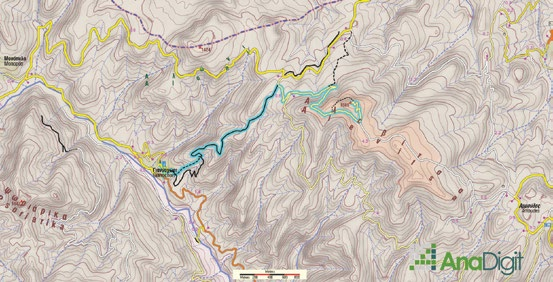
From the roadside section of Yannochori, we ascend a paved lane to the village’s large parish church. From here we will take an old dirt road, largely ruined for most of its length, that climbs up to Alevitsa. To shorten the first section, we will follow the old path, which — though clear and distinct — is barely discernible near the ravine’s axis. We will then join the old lane, built over the pre-war mule track that wound along the rocky ridge known today as the Yannochori Scale (Skala Yannochoriou).

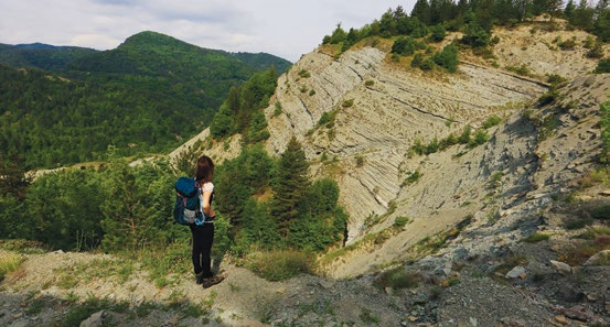
We emerge into a large meadow where we meet a wider dirt road and follow it uphill. Up to this point the landscape is largely barren due to the nature of the rock, with magnificent views over the Aliakmonas valleys.


A little further up, at the end of the large meadow, we come across a more prominent dirt road

Following this dirt road we will reach another fork, and end up at the summit of Alevitsa, where there are World War II fortifications and a guard post.


Route walkability
Distribution over
altitudinal zones
Elevation profile
Starting – ending point and maximum elevation

Tips
- On the plateau of Alevitsa’s summit, which is partly artificial, extensive fortification works from the Civil War period are visible — though mainly from the first post-war decade, as can be seen from the materials and techniques used.
- The entire summit crown, as well as the slopes of the hill, are dug up, and it appears that there was a labyrinthine network of interconnected trenches and areas for ammunition storage and accommodation.
Επισημάνσεις
- Water can be found occasionally at the overflow of the old aqueduct’s water conduit.