


Route type: Two-way
Difficulty: 1/5 (Easy)
Duration: 4h 30min
Length: 8km
Equivalent length: 8km
Ascent: 1013m
Descent: 49m
Maximum altitude: 2356m
Minimum altitude: 1390m
Drinking water: Yes
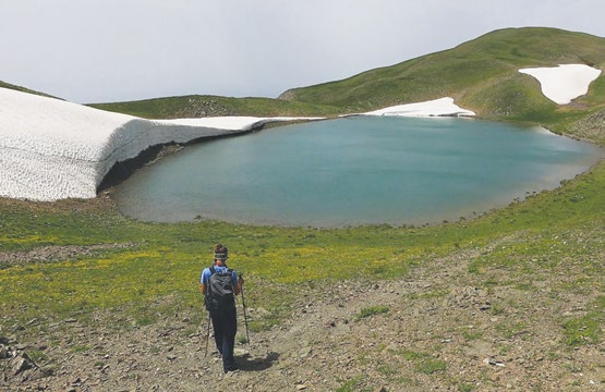
Gramos has many mountain lakes, such as the Arenes lake. Gistova, however, is the lake at the highest altitude — at 2,350 metres — on the northernmost arm of the Gramos ridge, right on the borderline with Albania.
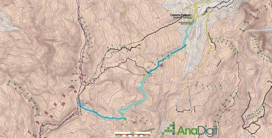
The ascent to Gistova via Fakou starts from the village of Gramos and follows a succession of livestock trails, heading for the sheepfold at Lefka. At the fork we follow the left branch and walk on the dirt road as far as the first visible ridge, where there is a neat tin shack (painted red).
At the shack we leave the road and ascend a small ridge on an indistinct path. Bearing left, we enter beautiful meadows with water and orchids. From the end of the meadow, we can pick the best among the various faint trail traces: we choose the line of the gentlest gradient, which skirts a steep slope and brings us to the middle of the three ravines of this zone.
Through the smooth ravine we reach near the “neck” of Gistova, where we converge with the path from 2520 and descend to the lake’s basin.
Route walkability
Distribution over
altitudinal zones
Elevation profile
Starting – ending point and maximum elevation

Tips
- When there are still snow patches on the mountain, it is preferable to move closer to the axis of the ridge.
- Water can be found in the streams of the area.
Remarks
- Although the dogs on Gramos are not dangerous, it is best to avoid the flocks and especially the sheepfolds, making a wide circle outside the animals’ unease radius.