


Route type: Two-way
Difficulty: 1/5 (Easy)
Duration: 4h 15min
Length: 10,9km
Equivalent length: 10,9 km
Ascent: 597m
Descent: 597m
Maximum altitude: 1207m
Minimum altitude: 796m
Drinking water: Yes
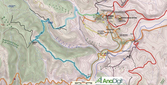
The Bear Trail in Nestorio is a long circular route starting from Nestorio. It is a passable variation of an older route, which was designed as a pilgrimage to the significance of the bear and its environmental needs.
The route starts from the centre of Nestorio, follows the road towards the helipad, and finally a logging lane towards Ammorema. We meet the old path to the Orsets settlement. Initially we descend towards the Dosnitsa watering trough, and then climb up to the ridge, where the first ruins of Orsets.

We continue descending towards the Aliakmonas, right along the axis of a smooth ridge.


We finally descend to the asphalt road, and after passing the entrance of the River Party site, we return to Nestorio.
Route walkability
Distribution over
altitudinal zones
Elevation profile
Starting – ending point and maximum elevation

Tips
- The last section of the descent has an elevation difference of 230m and is relatively difficult, due to the slope’s gradient and the faintness of the trail.
- The entire route includes 2.7 km on asphalt.
Remarks
- The route is well marked with a “red bear paw print” and several direction signs.