


Route type: Two-way
Difficulty: 3/5 (Difficult)
Duration: 5h 15min
Length: 7,2km
Equivalent length: 7,2km
Ascent: 881m
Descent: 70m
Maximum altitude: 2246m
Minimum altitude: 1357m
Drinking water: Yes
The summit of Goumpel lies on the Greek–Albanian border. Owing to its prominent position in the system of passes in the area, as well as the natural fortification provided by its rocky eastern crest, the summit played a particular role during the Civil War and was one of the most heavily fortified positions on Gramos. Indeed, the summit’s final cone bears a kind of perimeter wall of rubble masonry, with stone-built bastions and deep embrasures.
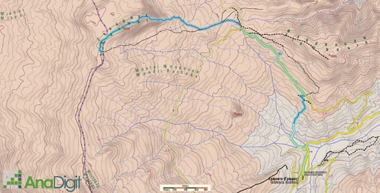
The route starts from the main road of Gramosta. After the large road bridge, we enter an old livestock trail and reach the dirt road to Fousia. The dirt road leads to the Barouga saddle, where it forks left for Gistova and straight on for the Mouza meadow. From here the path to the summit begins, marked with fairly dense orange marks — in places quite well-trodden, elsewhere indistinct.

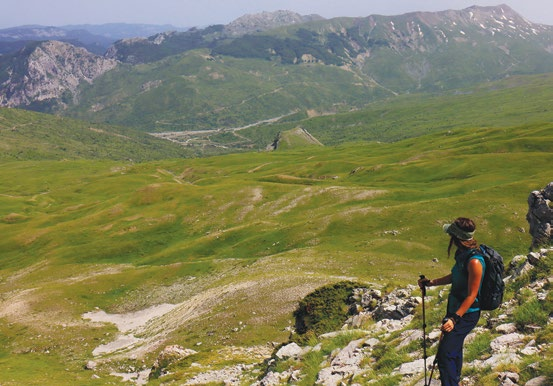
Soon, the marks lead through meadows to the base of the summit. Here the gradient changes abruptly, and the marks lead us through steep successive natural steps to the start of a rocky corridor/passage. We climb the broken rocks of the corridor without particular difficulty.

We continue on a rocky crest with easy technical passages as far as the grassy slopes of the summit. In the last metres before the summit we will encounter successive World War II fortifications surrounding the mountain’s southern side.


Route walkability
Distribution over
altitudinal zones
Elevation profile
Starting – ending point and maximum elevation

Tips
- On the dirt road we will come across a watering trough with abundant water.
Comments
- We can drive up to Barouga by vehicle (an ordinary car in summer; strictly a 4×4 in spring and autumn; in winter the road is closed by snow) and do only the last — and most interesting — part of the route.