


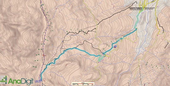
Route type: Two-way
Difficulty: 1/5 (Easy)
Duration: 3h 15min
Length: 7km
Equivalent length: 17km
Ascent: 1001m
Descent: 29m
Maximum altitude: 2379m
Minimum altitude: 1390m
Drinking water: Yes
Lake Gistova is one of the three great alpine lakes of Greece. It lies in the eastern part of Gramos, above the village of Gramos (Gramosta) and close to the mountain’s highest peaks, Perifano and the summit “2520”.
The ascent to Gistova starts from the village of Gramos and follows a succession of livestock trails, aiming for the few reference points of a rolling and rather indistinct terrain. After the high plateau of Patoma, adorned with 4–5 small alpine lakes, we continue on a relatively distinct path towards the ridge.
To reach the lake’s basin, a short descent is required. From the surrounding slopes we have an unobstructed view towards the Albanian border, but also towards the northern mountains of Epirus, most prominently Smolikas and Gamila.
Route walkability
Distribution over
altitudinal zones
Elevation profile
Starting – ending point and maximum elevation

Tips
- The slopes along the path to Gistova are dotted with violets of the species Viola epirota. The species has a Balkan distribution, and in our country it is found exclusively in the Northern Pindos.
- In May, Dactylorhiza sambucina adorns the mid-altitudes of Gramos.
- Gentiana verna is a characteristic early-blooming species of the subalpine meadows.
Remarks
- Most of the route follows a trail — in places clear and well-trodden, in places less distinct.