


Route type: Two-way
Difficulty: 3/5 (Difficult)
Duration: 6h
Length: 13,7km
Equivalent length: 13,7km
Ascent: 1361m
Descent: 260m
Maximum altitude: 2444m
Minimum altitude: 1390m
Drinking water: Yes
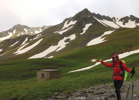
From the side of the Gramos village basin, the Perifano summit can be approached by two routes: either from the Kiafa–Perifano saddle, which is also where the old Gramos–Aetomilitsa connection passes, or from the Leventiko meadow, via the Skala path — the route we will describe here.
The ascent to the Perifano summit from Leventiko forms the “bridge” between the routes of the southern and northern arms of the massif. Indeed, via the traverse of the Skirtsi ridge one can connect Perifano with “2520”, and from there with the surrounding locations of Kiafa, Gistova, Farmaki, Perifano etc.

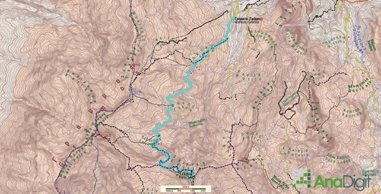
The route starts from Gramosta and, as far as Lefka and Fakou, follows the common course of the routes towards Gistova.

At 5.5 km from Lefka, on the dirt road, and after crossing the large stream formed by the Pentavryso springs — which forms an impressive waterfall — we arrive at the Leventiko meadow.

From the huts, we will aim for the broken rocks on the left, on a distinct trail trace, which runs through rocky slopes and scree. After a first shoulder, where there is a sign indicating that this route leads to Perifano, we arrive below a more compact rocky height, which we skirt on the left.

The trail trace makes a long open sweep on the smooth slope and climbs towards the broad col between Perifano and 2520. We reach the col with a few switchbacks and meet the old military road Aetomilitsa–Gkesos–2520. From this spot, we will move left, onto the trace of the old road.
Soon, this lane enters beneath the black dominance of the precipitous passage of the Skirtsi height. Coming out of Skirtsi, we will need to climb quite a bit, always on the trace of the old road, which will bring us smoothly to the southern base of the summit’s cone, where we will arrive easily.
Route walkability
Distribution over
altitudinal zones
Elevation profile
Starting – ending point and maximum elevation

Tips
- We will find water at the spring between the huts. Note, however, that until the flocks come up, the waters of the large streams are crystal clear.
- Water at Pentavryso. The route crosses or continues with most of the alpine routes of Gramos.
Comments
- The route is well marked.