


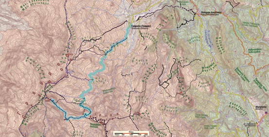
Route type: Two-way
Difficulty: 3/5 (Difficult)
Χρόνος πορείας: 10h 30min
Length: 13,7km
Equivalent length: 13,7km
Ascent: 1361m
Descent: 260m
Maximum altitude: 2505m
Minimum altitude: 1390m
Drinking water: Yes
Although little known and quite “rolling” on the map, the approach to Tsouka Petsik (or “2520”) via the rocky ridge of Skala is the ascent to the highest peak of Gramos that requires the least effort and rewards you with the finest views.
The route starts from Gramosta and, as far as Lefka and Fakou, follows the common course of the routes towards Gistova.

We follow the road to Leventiko, where — leaving the valley on our right, where the classic ascent of “2520” continues — we bear left onto a distinct path that enters the shadow of the massive rocky massif of Skala.

The trail brings us to the Skirtsi ridge. Here we turn right and follow the crest of the ridge to the summit.


Route walkability
Distribution over
altitudinal zones
Elevation profile
Starting – ending point and maximum elevation

Tips
- You will find water at Pentavryso. The route crosses or continues with most of the alpine routes of Gramos.
Comments
- The route is well marked.