


Route type: Two-way
Difficulty: 1/5 (Easy)
Duration: 2h 45min
Length: 5,6km
Equivalent length: 5,6 km
Ascent: 438m
Descent: 229m
Maximum altitude: 1542m
Minimum altitude: 1185m
Drinking water: Yes
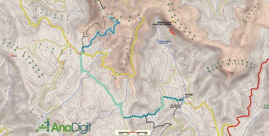
The route Nea Kotyli–Palia Kotyli follows — and reveals — the old mule track that the inhabitants of Kotyli used before the war to communicate with Nestorio, where they often went down for transactions, shopping and administrative matters.
Starting from the centre of Nea Kotyli, we pass the “1450” guesthouse and, via a good path, reach the road serving the National Reconciliation Park.
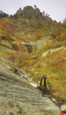
We enter a long descending course and continue on a long traverse that passes at the base of the sandstone wall of Gkourousia.
Arriving below the edge of the cliff bearing the eloquent name of Charos (Death), we begin the descent via the old “scala” (stone stairway), which zigzags along the edge of a cutting.
We end up on the dirt road of Palia Kotyli and from there at the old village.
Route walkability
Distribution over
altitudinal zones
Elevation profile
Starting – ending point and maximum elevation

Συμβουλές
- Thanks to its rocky passages, this route is the most impressive trail on Gramos.
Επισημάνσεις
- The route is well marked with a green circle and several direction signs.