


Route type: Two-way
Difficulty: 3/5 (Difficult)
Duration: 3h 45min
Length: 6,6km
Equivalent length: 6,6 km
Ascent: 855m
Descent: 105m
Maximum altitude: 1827m
Minimum altitude: 981m
Drinking water: Yes
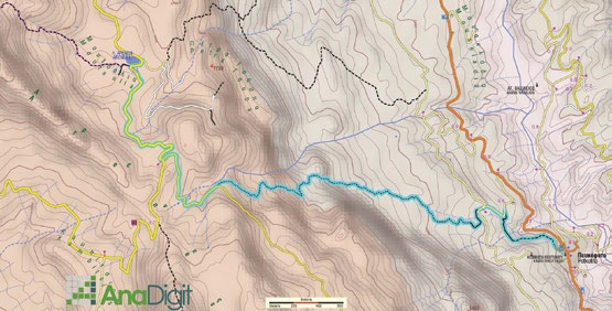
There are at least three hiking approaches to the Moutsalia lakes (Arenes Lakes) from Pefkofito. The most passable of these trails is well marked and leads us from Pefkofito to the “heart” of Gramos.
The clearest and most clearly marked route starts from the centre of Pefkofito, next to a large stone fountain, and ascends along a cement lane that passes opposite the village’s water tank. After a ravine, we emerge onto a large forest road (successive direction signs).

The road forks, climbs and ends deep in the forest: from here a faint but well-marked trail begins, leading to a forest road below the lakes.


We follow the lane to the lowest — and largest — lake.
Route walkability
Distribution over
altitudinal zones
Elevation profile
Starting – ending point and maximum elevation

Tips
- You will find water in Pefkofito, in the streams, at various small springs, and at the fountain in Moutsalia.
Επισημάνσεις
- The route is 6.6 km long and can be completed in 3 to 4 hours. • The entire route runs through dense beech forest and clusters of conifers, and is shaded throughout.
- The trails present passability problems and must be approached with caution